Forbidden City Map
Description
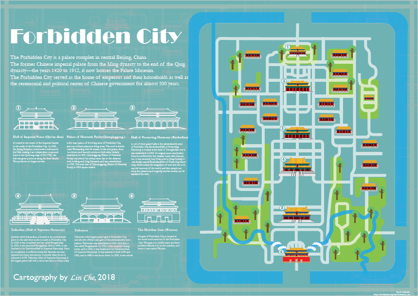
The Forbidden City is a palace complex in central Beijing, China. The former Chinese imperial palace from the Ming dynasty to the end of the Qing dynasty (the years 1420 to 1912), it now houses the Palace Museum. The Forbidden City served as the home of emperors and their households as well as the ceremonial and political center of the Chinese government for almost 500 years.
This work is aiming to map Forbidden city in flat design and highly generalized way.
Geographic spatial reference is obtained from Open Street map.
All the text is from Wikipedia, https://en.wikipedia.org/wiki/Forbidden_City
ArcMap and Illustrator are used in creating this work.
Click on the image for a fully version of the map.
- June 2018